


Antique 1882 DELAWARE RIVER U.S. Coastal Survey Map by J & C Walker
Antique 1882 DELAWARE RIVER U.S. Coastal Survey Map by J & C Walker
MATERIAL: Engraving
CONDITION: Very good antique condition. Engraving is fully legible. Age-appropriate wear, tearing, and rubbing on the edges/corners, but not reaching the area of print. Light toning of page, consistent with age. Minor creasing and light soiling is present throughout – see photos.
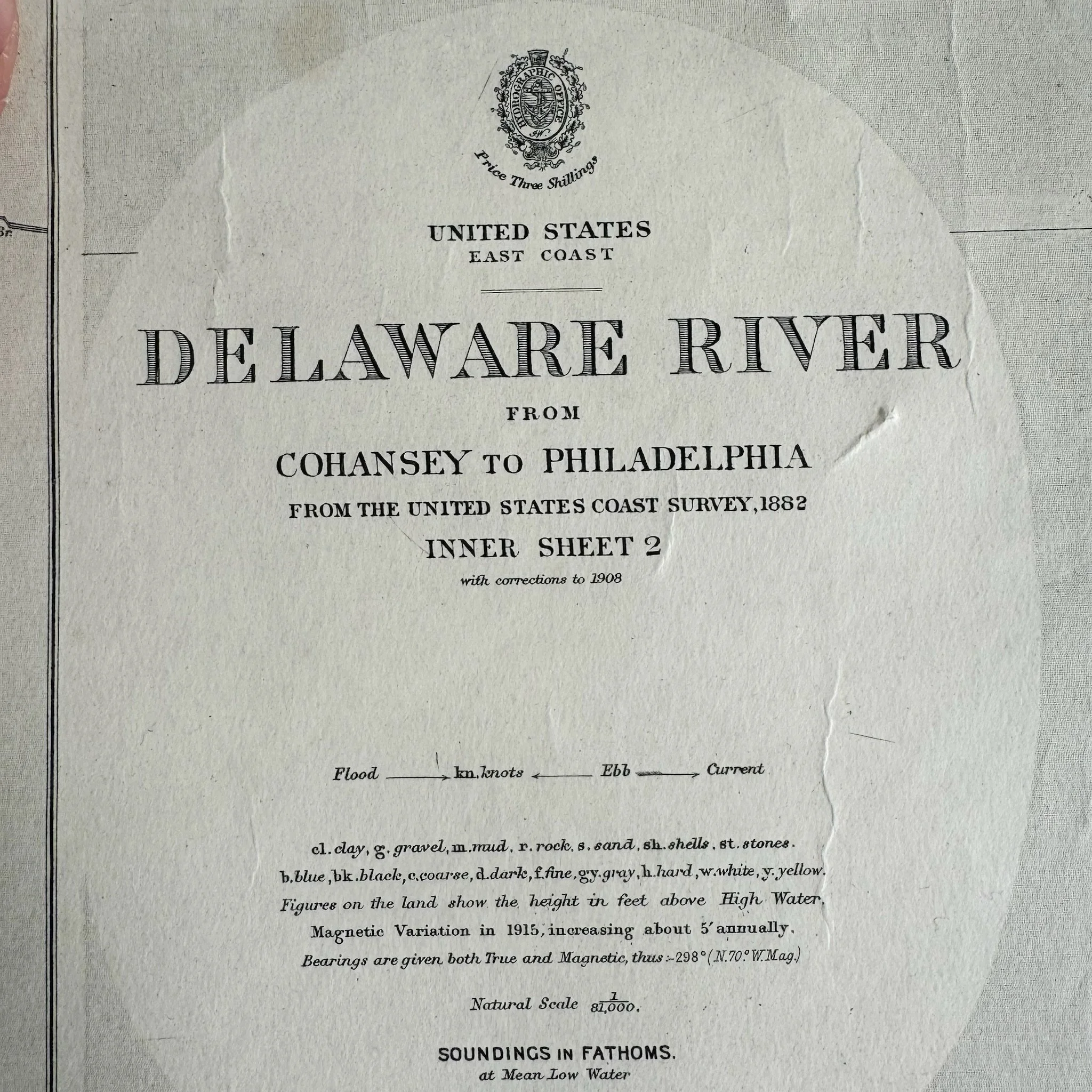
DETAILS: Rare collectible Antique 1882 U.S. Coastal Survey map of the Delaware River from Cohansey to Philadelphia showing soundings in fathoms, engraved by J. & C. Walker. This edition is No. 2564 from June 18, 1915. J. & C. Walker was the imprint used by the Walker family of engravers and printers. They produced numerous high-quality geographical maps and nautical charts for a variety of institutions in the nineteenth century—this particular map was published in London under the superintendence of Hydrographer Captain Washington RN. F.R.S.
MEASUREMENTS: 27"W x 40.5"H
Pickup in Gowanus M/W/F from 10am-3pm.
Antique 1882 DELAWARE RIVER U.S. Coastal Survey Map by J & C Walker
MATERIAL: Engraving
CONDITION: Very good antique condition. Engraving is fully legible. Age-appropriate wear, tearing, and rubbing on the edges/corners, but not reaching the area of print. Light toning of page, consistent with age. Minor creasing and light soiling is present throughout – see photos.
DETAILS: Rare collectible Antique 1882 U.S. Coastal Survey map of the Delaware River from Cohansey to Philadelphia showing soundings in fathoms, engraved by J. & C. Walker. This edition is No. 2564 from June 18, 1915. J. & C. Walker was the imprint used by the Walker family of engravers and printers. They produced numerous high-quality geographical maps and nautical charts for a variety of institutions in the nineteenth century—this particular map was published in London under the superintendence of Hydrographer Captain Washington RN. F.R.S.
MEASUREMENTS: 27"W x 40.5"H
Pickup in Gowanus M/W/F from 10am-3pm.